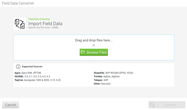
Guidance system and field data converter
Making field data available for the entire fleet
In mixed fleets, using the same field boundaries and waylines for guidance is a challenge. Tractor manufacturers of various brands and suppliers of retrofit solutions use different formats for field data to perform guidance. FendtONE offboard helps you to convert your field data:
- Uploading field boundaries and waylines from various sources
- Conversion to the desired target format
- Download field boundaries and waylines converter
The field data converter in FendtONE offboard supports the following formats and field data:
Upload:
- AGCO: AGCO KML (PFTM)
- ISOXML: 2.0, 2.1, 3.0, 3.3, 4.2, 4.3
- TopCon: Autoguide 1000 & 3000, 3.19, 3.20
- Shapefile: SHP WGS84 (EPSG: 4326), Telepac
- Trimble: AgGps, AgData
Download:
- AGCO KML: Field boundaries, A-B lines and curves
- ISOXML: Field boundaries, A-B lines and curves
- Autoguide 1000: A-B lines Autoguide 3000: Field boundaries, A-B lines and curves TopCon 3.19 & 3.20: Field boundaries, A-B lines
- Shapefile (WGS84): field boundaries, A-B lines and curves
- AgGps: Field boundaries, A-B lines and curves
Other: GeoJson

